Preface:
At the time of our visit, Hyperion, standing at 115.85 m (380 ft), was recognized as the tallest known tree in the world. Since then, the National Park Service has closed access to Hyperion and the surrounding area to protect the tree, its exposed root system, and the fragile slope on which it grows. Repeated foot traffic, erosion, and informal trails have put the site at risk.
Because of that, I have removed route details and ask readers not to seek it out. The redwoods are extraordinary, but some places are best protected by letting them remain undisturbed. Please enjoy Redwood National and State Parks through open trails, marked groves, and ranger-approved areas.
Full Story

Introduction:
Towering like skyscrapers, the mystical redwood forests along the Pacific coast in northern California and southern Oregon are a sight to behold. Redwood National and State Parks in California are an obvious choice when seeking out these wonders. Growing up in a town built around the Redwood Highway, I feared I had taken their presence for granted. Hiking under these giants, or even driving through redwood groves on scenic roads, is humbling. As we planned to move to the Midwest in July 2020, I knew I needed more time with the trees.
Before moving, I wanted to visit some of California’s most remarkable trees. General Sherman, a giant sequoia believed to be 2,200 to 2,700 years old, is relatively easy to access in Sequoia National Park and holds the record as the largest tree in the world by volume. Hyperion, a coast redwood in Redwood National Park, was recognized as the tallest known tree in the world at the time of our trip. Unlike General Sherman, Hyperion was never meant to be a public destination. Its location was not marked, and access has since been closed by the National Park Service to protect the tree and the fragile landscape around it. This account reflects a past visit, not a route or invitation to seek it out.
To the Trailhead:
We drove through the twisting forest roads of Northern California, near the Hoopa Valley, home of the Hoopa Valley Tribe. The towering redwoods were immense. At hundreds of feet tall, it is nearly impossible to tell which trees are taller than others. How on earth could we tell Hyperion from its unnoticeably smaller neighbors?
At the time of our visit, we planned our trip around a legal public access point in Redwood National and State Parks. We were camping out of our 4×4 rig and wanted to spend the day among the redwoods before continuing north to camp that evening.
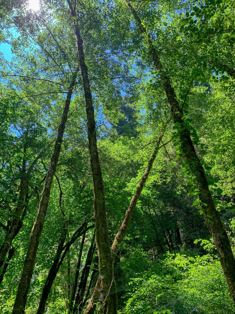
The drive into the park was beautiful in its own right. The road climbed and curved through dense forest before descending deeper into the redwoods. Even before we began hiking, the scale of the landscape was hard to process. These were not just big trees. They were old-growth giants, standing in a place that felt older and quieter than the roads leading into it.

As we continued deeper into the park, we were surprised to find we were not alone. There were a few other vehicles nearby, and we saw backpackers making their way through the area. Many people were there simply to enjoy the established trails, beautiful redwood groves, and wide creekside landscapes.
We parked our rig and got ready for the hike. At the time, our route took us through wet and uneven terrain, including creek crossings that could be dangerous depending on season and water levels. Looking back, that difficulty is part of why Hyperion was never suited for regular visitation. The surrounding landscape is fragile, easy to damage, and now closed to protect the tree and its habitat.
The Tall Trees Trail:
The trail starts relatively level before dropping through minor switchbacks into the valley. Like our drive into Redwood National and State Parks, the trail was filled with soaring trees. The entire hike down the hill sat under the shadow of the redwood canopy, which made things feel a bit chilly despite the hot, dry California summer.

Throughout the hike, we passed giant fallen trees that had become home to moss, clovers, and new growth. Some had left gaps large enough for us to walk under the toppled trunks. As the trail leveled out, we arrived among the redwoods and found a quiet place to pause, look up, and take in the scale of the grove.
This established trail is worth visiting on its own. It offers a beautiful way to experience old-growth redwoods without entering closed areas or damaging fragile habitat. For anyone visiting today, staying on marked and open trails is the best way to enjoy the forest while helping protect it.
Slippery When Wet:
We made it to the creek and now it’s time for the wet part! Remember, if it’s even slightly chilly out, the water can be bitterly cold. Any point around the wet season, the water level will be high and the current extreme. It is dangerous and impossible to cross during this time of year! It’s a pretty rocky creek and almost the entire trail from here to Hyperion will be in the water. We knew to attempt this hike in summer, so the water was quite refreshing and we had selected our clothing and gear accordingly (see list below).
From stepping off the main trail, we walked straight to Redwood Creek. From where we were standing on its banks, we looked across and to the left to find the mouth of a smaller tributary creek. This is the Tom McDonald Creek, where upstream, Hyperion sits up on its bank. The area where the two creeks connect is quite overgrown, but following Redwood Creek a hundred feet or so upstream, it becomes more visible.
We started our way into Redwood Creek at its widest point and marched to the mouth of the Tom McDonald. For the most part, it was much smaller and lower than Redwood Creek, but there were several avoidable spots where it dropped more than waist-deep. When hiking in wet conditions such as this, we line our backpacks with drybags to keep things waterproof. The hiking water shoes we picked up at an REI parking lot sale helped protect and maintain traction on the rocky river bed. We recommend these for anyone who enjoys hiking in water. Though we were trying to avoid it as much as possible, the occasional dunk into the deeper sections was part of the fun.
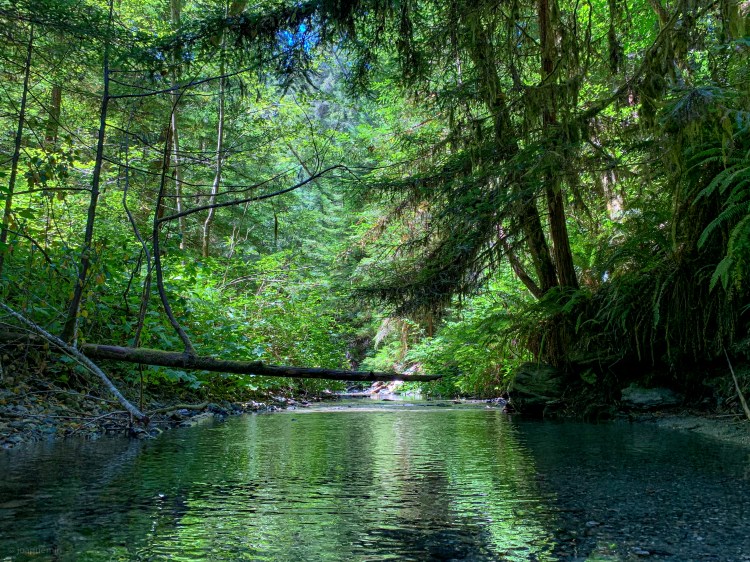
The trees (most being tall redwoods) shrouded the creek from the sun. Everything was damp and moss managed to grow just about everywhere. The banks were covered in ferns and we were incessantly amused by frogs leaping in every direction from our path. Shortly up the creek, there was a very large downed tree. We managed to crouch and pass underneath, but this would not be the last roadblock. The next set of downed trees required us to climb up the bank and make our way across their slippery bark. As the creek continued, we found a couple small sections deep enough for a swim. If you’ve been backpacking all summer day, this could offer a nice refreshing break. Compared to the busier Redwood Creek, it also granted a bit more privacy. Eventually, we were once again forced to hike up the bank and around another massive log cluster, but at this point, we were almost there! We had GPS coordinates of “roughly” where it was (see detailed list) and heard of folks making their way up the creek encountering three sets of fallen trees blocking the way to Hyperion. This was our third pile of logs and we were close to the coordinates.
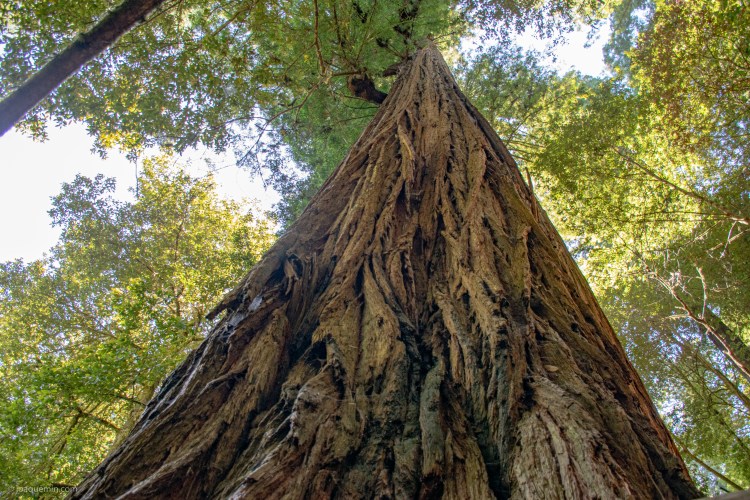
We kept our eyes to the right side of the creek, but there were dozens of redwoods that we felt could be the tallest. One clue is that Hyperion has a very close friend. They stand as a pair about 20 or 30 feet up the creek bank. It looks like there used to be a smaller third friend, but it has since fallen towards the creek clearing the overgrowth for a better view. Unfortunately, we were enjoying the hike a tad too much and missed all this on our first pass. So we continued up stream for a while more. We eventually reached a fourth and VERY large fallen tree. We climbed on top to get a better view and see if we can make heads or tails of the many record breaking candidates.
Ultimately, we turned back. We knew our best chance was to walk between the two sets of fallen logs. It was on the return that we noticed the very tall pair of redwoods, the right being Hyperion. We climbed up the bank and took extra care not to disturb their root system. The tree that had fallen offered a safe platform to stand upon. It is obvious people have been climbing all around the base of Hyperion. The ground was eroded, and with it, the exposed base was also deteriorating. Water is washing the dirt from between the roots and this could lead to Hyperion being the next big road block along this creek. Please tread lightly when visiting for the tree’s sake.
We got some photos and had lunch under the shade of the world’s tallest tree. To make it back to the Tall Trees Trail head, we just retraced our steps. The journey back down the creek was downstream which made things a bit easier. Once we crossed Redwood Creek though, it was all uphill to the parking lot.

